Polar vortex sends arctic blast into New York, putting tri-state under freeze warning
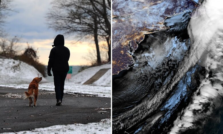
New York City got its first snow of the season on Tuesday as a powerful polar vortex swept across the eastern half of the country, bringing frigid temperatures.
Highs are not expected to break out of the low 40s with a wind-chill of between 25 to 35 degrees as wind gusts of up to 40 mph bear down on the Big Apple, according to the National Weather Service.
Scattered snow flurries started falling around the city in the morning, but it is not expected to accumulate, forecasters said.
“Due to the lack of available moisture, there is [just] a small chance of light snow today,” Fox Weather Meteorologist Stephen McCloud said.
The massive polar vortex has pushed arctic air from Canada into the Empire State, bringing an unseasonably early taste of winter to 100 million people, including the tri-state area, which is under a freeze warning.
“A strong dip in the jet stream has brought cold air in from Canada across the Eastern US,” McCloud said.
“Temperatures will slowly rise today into the 40s, but temperatures will return to closer to average by Wednesday,” he added, noting that the bulk of the system’s snow will be seen across the Great Lakes and interior Northeast.
New York City officials warned residents to dress warmly and take extra care while walking, biking, or driving due to slick conditions and frost that could form on windshields